Marsannay-la-Côte, belvedere, 171.6 million years ago.
Publié 05/07/2019 14:06:28 Modifier 16/07/2020 16:20:30 par 489945901
View over the plain of Marsannay-la-Côte.
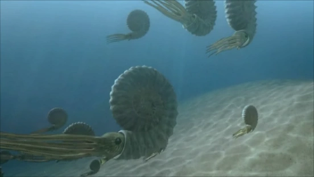
The place where you are was a seabed between 3 to 6 meters deep, -171.6 million years ago.
But why is it high today?
This place is 420 meters above sea level.
Towards the South East, at 318 ° and at a distance of 217 Kilometers, is Mont-Blanc in the Alps.
About -40 Ma ago began the birth of the Alps caused by enormous lifting forces when moving the tectonic plates.
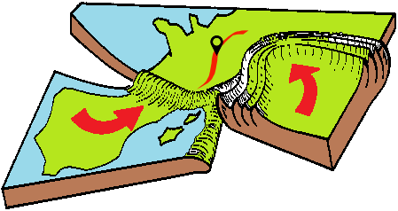
The ancient seabed found itself pushed upwards, forming a ruff from South to North, from the Auvergne region to Lorraine, in other words from Puy de Dôme to the Vosges mountains.
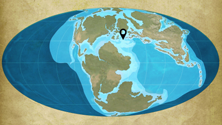
The black marker indicates to you where the place is located approximately.

The ground is classified on a geologic map Jurassic Middle Bajocien superior ( j1b ), at this very distant time the place is a seabed.
In a landscape of great beauty and in a hot and humid climate the turquoise waters dotted with lagoons sheltered terrifying monsters.


Video to see absolutely, it is in French language: Burgundy at the origin of the soil.
You can make a donation with PayPal © from € 1 to help the website, thank you in advance for your help!